Subsurface Utility Engineering
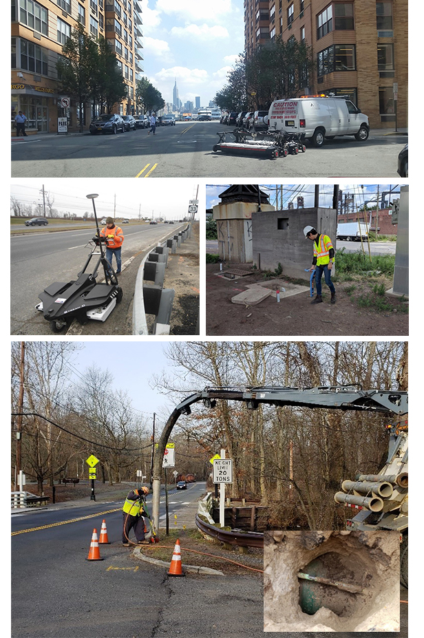
With AID’s unique, state-of-the-art Ground Penetrating Radar (GPR) systems, we can accurately, rapidly, and comprehensively identify/verify any existing and abandoned utilities that exist within project limits.
Unlike other systems, this technology allows for accurate detection and mapping of existing utilities both laterally (X-Y) and depth-wise (Z) at a reduced cost with minimal need for MPT. Ground Penetrating Radar are complemented with electromagnetic induction methods (EMI), consisting of pipe/cable locators which can be used to trace out cast iron pipes and metal lines, utilities that have tracer wires, and inactive power and communication lines. The combination of GPR and EMI is a method for fast-tracking design, as results are easily exported onto basemap plans and for accelerating construction, as potential conflicts are reliably identified and addressed at design, avoiding costly (in terms of time and money) surprises during construction. Whenever required, AID can also can perform Quality Level A investigations to expose the utilities of interest using hydrovac excavation, allowing the depth to be measured directly to the utilities and asses their type/size.
- Quality Level D
- Existing records and verbal recollection
- Quality Level C
- Surveying of above-ground features, and
- Correlation with existing records.
- Quality Level B
- Ground Penetrating Radar (GPR)
- Single and multichannel systems (up to 40 antennas)
- Covering up to 6’ wide on each scan
- Depth Range: up to 8’ (depending on type of soil)
- Scan speed: walking speed, and up to 9MPH
- Electromagnetic Method (EMI)
- Ideal for metallic and some non-metallic utilities
- Wide range of frequencies for active and passive locating
- Very effective in most types of soil.
- Depth Range: up to 20’
- Quality Level A
- Actual exposure of utilities via vacuum excavation

