Tunnel Scanning and Mapping
AID is the leader in tunnel scanning services. Incorporating the most advanced 3-D laser scanning system (A SPACETEC system), AID has assisted many tunnel owners with assessment and documenting damages of tunnel linings.
Our service has proved to be essential as high-resolution imagery, thermal profiling and 3-D profile of tunnel lining allows the extent and quantities of repair to be accurately documented. A complete suite of software allows for measurement, mapping and a virtual “drive-thru” of the tunnel while displaying the distresses and anomalies. The smart database within the software documents any and all tunnel damages (debonding, moisture, cracking, etc.) tied to their reference points so an overall report of the health of the tunnel lining can be obtained. In addition, cross sections can be exported into DXF (CAD) format with ease.
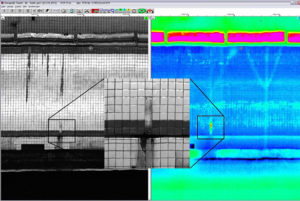
- Visual Image
-
Visual Survey + Condition Survey + Crack
Detection:
- High resolution image allows close inspection of distresses
- As small as 2 mm cracks are seen on the images
- Accurate references to actual image in the tunnel
- Measure and map (trace) cracks within software
- Observe moisture and extent of cracks
- Direct correlation with Thermal Image


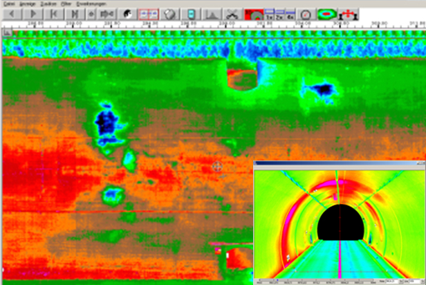
- Thermal Image
-
Moisture Detection + Water Intrusion +
Debonding/Void Detection:
- Temperature gradient allows for detecting anomalies
- De-banding/voids
- Water intrusion
- Moisture detection
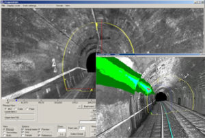
- 3D Profile
-
Damage Survey + Profile Survey + Clearance
Measurement:
- 10,000 survey-grade xyz coordinates per each line-scan
- 360 Degree data recording using the scanner’s rotating mirror
- 3D Zoom & zoom in/out capability
- Distance/Height/Volume computation
- Clearance measurement & charting


- Project damage summary
-
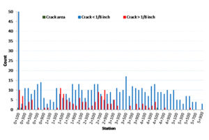
Detailed summary of distresses presented at their
precise location (i.e., MP or Station)
- Summary of distress and anomaly quantities along the length of the project
- Allows for a quick assessment of overall project
- Points to critical locations where attention is needed
