Railway Geometry & Inspection
Laser Rail Inspection System (LRAIL)
Our cutting-edge technology combines 3D-Laser imaging, LiDAR, 360° cameras, Inertial Profilers, and GPS to revolutionize track asset condition monitoring. Using an Integrated Testing Hi-Rail Vehicle, we collect comprehensive data with minimal track disruption. Our advanced AI models analyze this data, complemented by expert visual confirmation, to deliver unparalleled insights into railway infrastructure.
Whether you need focused reports on specific elements like tie and joint bar conditions, or a complete overview of your track assets, our flexible system delivers. With a single data collection run, we offer you the freedom to prioritize your inspection needs while optimizing your budget. Experience the power of precision, speed, and adaptability in railway inspection with our state-of-the-art services.
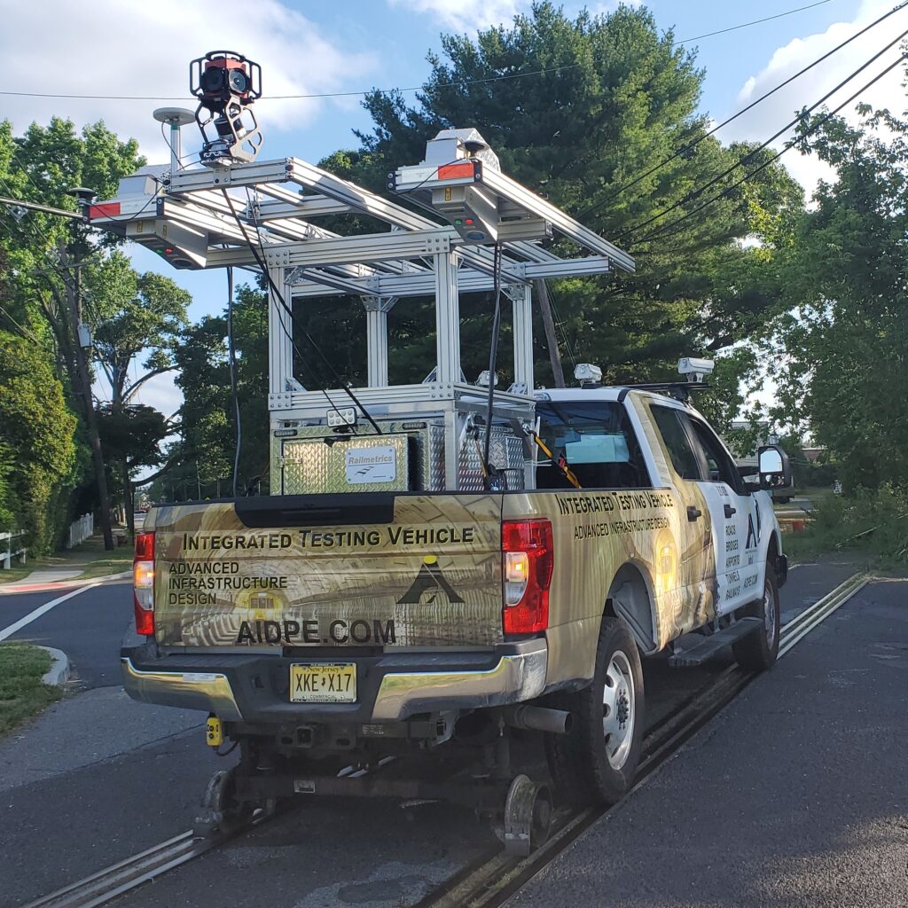
View of the ITV, showing the 360° Camera, GPS receiver, and LRAIL scanners.
LRAIL: Automated Track Inspection
- 1mm resolution scanning of the truck bed
- Identifying vertical differences as small as 0.1mm
- Tie inventorying (location, skew, chip, & crack detection)
- Spike and Fastener detection and status (location, missing, covered, height/loose)
- Joint and Joint Bar inspection (location, gap size, number of bolts)
- Rail Geometry (gauge, superelevation, alignment)
- Ballast inspection (volume)
- Data Collection at speeds up to 40mph
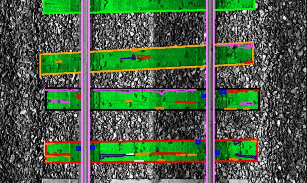
Image showing Wooden Tie Analysis and Rating. The top tie is acceptable, the orange-bound tie is “Damaged”, the red-bound tie is “Severely Damaged”. and the black-bound tie is “Failed”.
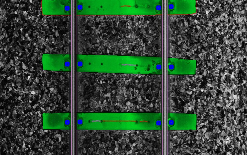
Image showing Concrete Tie Analysis and Rating, as well as fastener identification. The top tie is “Severely Damaged”, and the middle and bottom are considered “Failed”.
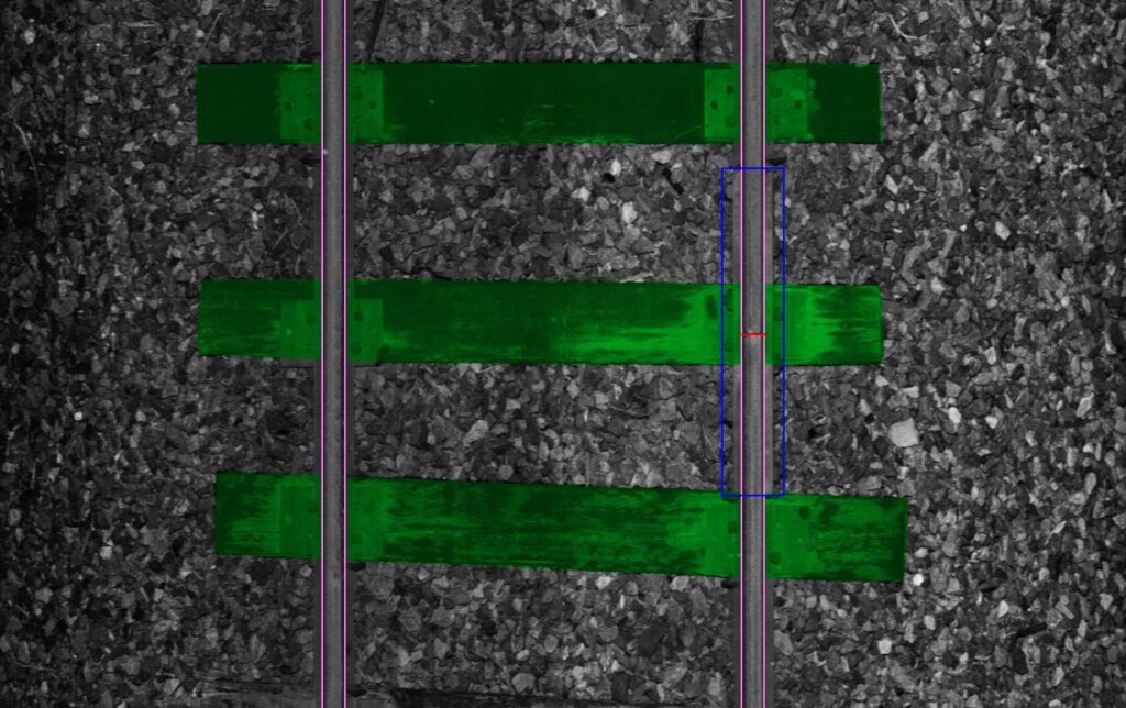
Image showing Joint Bar identification. Analysis results identified six (6) bolts, the joint itself, and the gap between rails.
LiDAR: Clearance and Right-of-Way Measurements
- Clearance measurement and charting
- Identification of Right-of-Way objects
- Highway-Rail crossing geometry inspection
360° Camera: Visual Confirmation of Results
- Stitched together imagery provides panoramic views of the track and surrounding area
- Allows checking of outlier data without requiring more on-track time
- Identification of “flat” information, such as writing and color
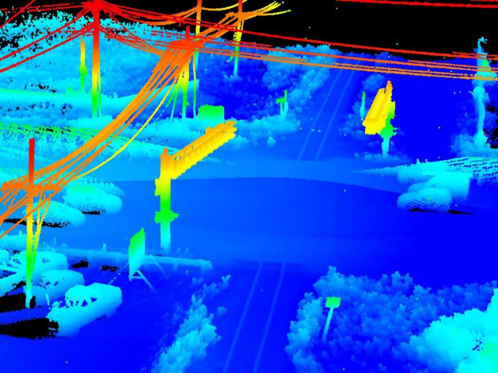
View of LiDAR scan, showing a highway-rail crossing with overhead signals.
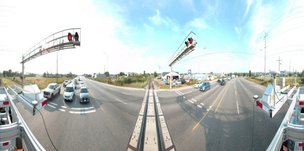
360° Camera view of the same crossing, providing details not seen in the LiDAR.
